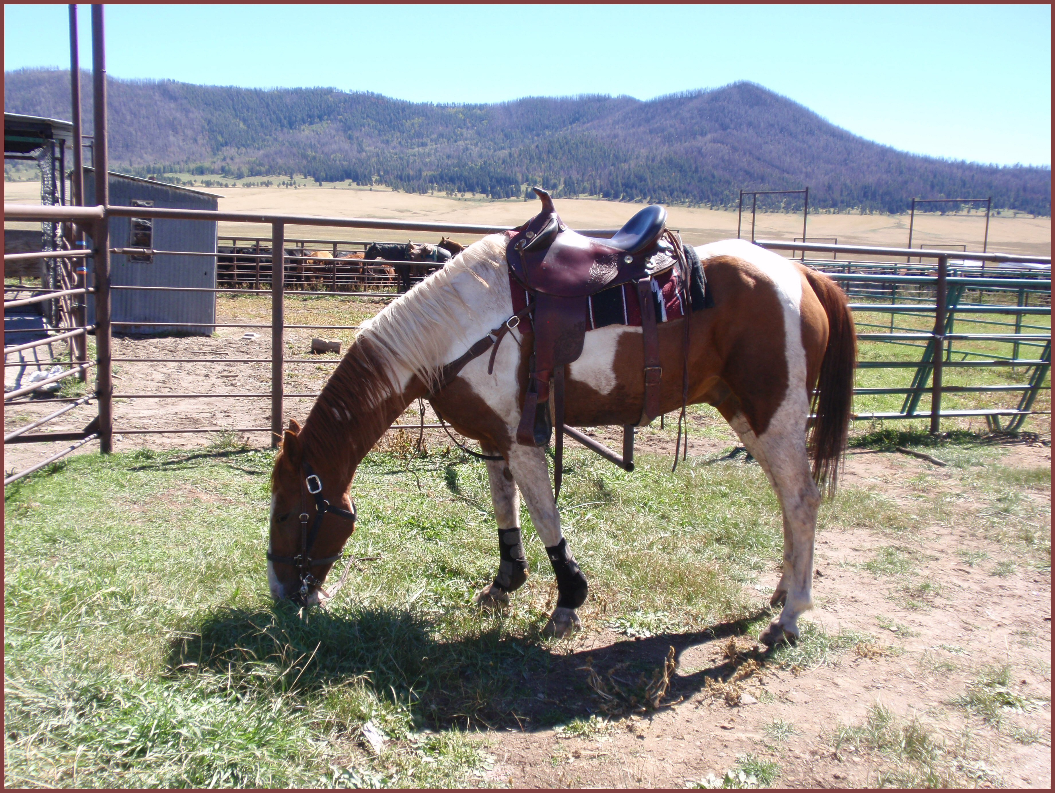
Hiking is absolutely one of my favorite things to do, so even though the weather has not been conducive to hitting the trails lately–nor has my schedule–a series on celebration has to include it. Here are accounts of four hikes on (mostly) my favorite trails in the area.
Pino Trail
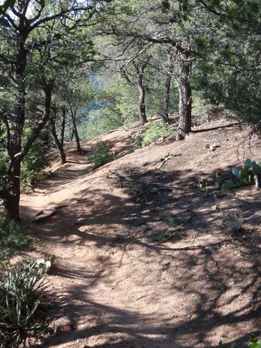
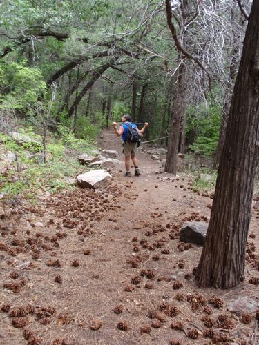
Pino Trail is my go-to hiking trail for two reasons. (1) It’s just over a five-minute drive from where I live. (2) The variety and the views never get old. These photos were taken on a short solo hike on a late afternoon in the summer, with the temperature around 94 degrees in the unshaded stretches. I went out by myself to see how the ribs I’d bruised the previous week handled my day pack and the heavy breathing from a little extra exertion.
This trail is very popular, but during my two hours out there I encountered fewer than half a dozen other people; apparently the heat kept everyone else away. My bruised ribs proved not to be an issue. In fact they felt better after the hike than they did before.

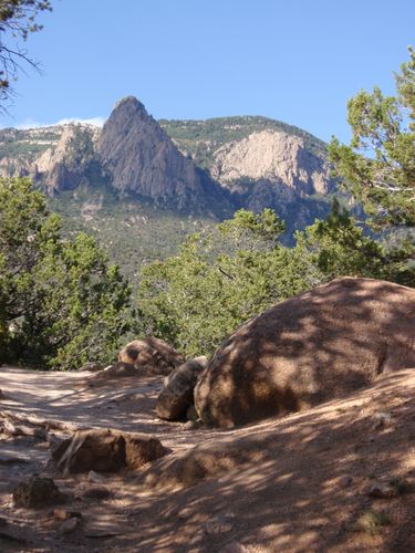
While I love all the gorgeous vistas from this trail, the shot directly above is my favorite.
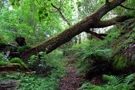
Cienega (“Wet Meadow”) Trail
This hike was definitely not a hit. On the way up, my hiking partner and I heard the growl of either a black bear or a mountain lion, and on the way down I took a minor spill on the uneven, rock-strewn path.
On the plus side, we gained 1,750 feet in a little over two miles, moving under continuously blue skies with a scattering of bright white clouds, in very comfortable conditions. The view from the top was amazing. A stone outcropping provided convenient level seating for a snack break (watermelon and almonds) and the opportunity for us to take it all in–along with a few photos, of course.
The less said about the trek down, the better. Of the wildflowers in bloom, sunflowers dominated. There were also more butterflies flitting around than I’ve ever seen anyplace outside the Butterfly Pavilion at the Botanic Garden.


Tree Spring Trail
Tree Spring Trail, one of the most enjoyable trails in the area, is located on the eastern side of the Sandias, which makes it a cooler and more comfortable hike in the summer. My hiking companion and I started from Tree Springs trailhead off Crest Highway, hiked up to the crossroads where Tree Spring Trail meets 10K and Crest trails, and then meandered along 10K for a while.
 This hike was a winner, even though the trails are popular for mountain bikers, and we had to do a lot of scrambling to get out of the way. I couldn’t believe the profusion and variety of wildflowers.


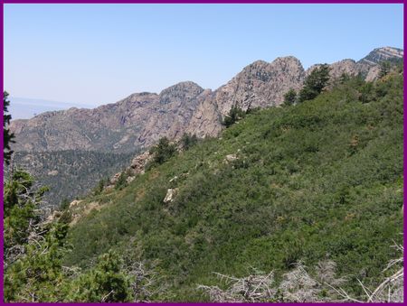
Piedra Lisa (“Smooth Rock”) Trail to Rincon Spur
The weather gods provided an absolutely perfect day for hiking this trail, most of which is in the open. The temperature ranged from low 70s to mid-80s, the sun shone brightly, and there was nary a sign of rain.
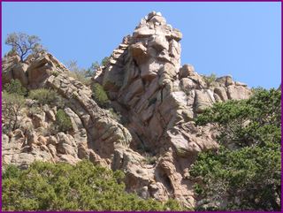
Piedra Lisa Trail is on the same side of the mountains as Pino Trail, so the terrain is similar, but being north of Pino it offers much closer views of the landmark shield, prow, and needle. My favorite, however, was this sphinx-like “rock face.”
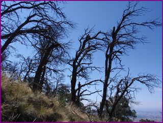
 There were lots of gnarled dead trees along the trail. At one point I turned around to see this row running down the side of a hill.
The number of wildflowers was surprising. I managed to get a few halfway decent shots and to identify a couple more species–both purple.


The mountains and sky seem much closer from the perspective of the trail. They’re a good reminder to look up from time to time, to check out the distant view. Sometimes you need the wide-angle lens.
A Gal and Her Camera:

Photo courtesy of Lee (Thanks!)
After parking in the small lot before the Cienega Canyon trailhead, my companion and I backtracked up the asphalt, getting the hardest part of the hike over with right away. We picked up Cienega Horse Bypass Trail, which eventually merged with Armijo Trail, which offered some dramatic views. Armijo Trail was also where we encountered this little guy (or gal?):

Armijo Trail ends at Faulty Trail, which runs 8.7 miles altogether, but is an interior or connecting trail, so you can’t get to it directly. We could have gone either north or south, and chose north to make our loop. The terrain on both Armijo and Faulty was up-and-down, which was unusual and very welcome. Most of the time you figure on going UP. And then coming back DOWN. A portion of Faulty Trail follows an actual fault called Flatirons Fault.

I can’t get enough of this place. It’s awe-inspiring, wild, and restorative all at the same time.
I think it was on Faulty where a fellow hiker warned us he’d seen a bear off-trail about 200 yards back (in the direction we were headed). Just before Faulty crosses Cienega Trail, there is a short, very steep descent against the north face of Cienega Canyon. The views were spectacular! I failed to capture the grandeur, but I did succeed in making it down, which was sufficient accomplishment.
After the short leg of Cienega Trail, we snacked at an actual picnic table, then crossed the asphalt road to check out Cienega Nature Trail. We were reminded that Cienega means “wet meadow.” The area was very different from the trails we’d been on across the road. Green. And open.

Lastly, we hunted for Acequia Trail for a bit before finding and following it in the direction of the parking lot, thus completing the loop. Pine cones abounded. And my friend Lee waited patiently while I took yet another photo.
This very pleasant hike was five miles in all. It’s one I would definitely do again.
This post is part of April’s 30 Days of Celebration. To read more, click on the Celebration category link.

 It’s the middle of April, and I have been hiking a six-mile loop of trails at Bear Valley Trailhead in Point Reyes National Seashore: Bear Valley trail to Pine trail to Sky trail, and back on Bear Valley.
 The human brain processes around 11,000,000 bits of information at a time,

 I love to look at all the trees and the wildflowers in this area, along with the roadrunners and occasional coyote. The cottonwood trees along the Rio Grande bosque turn into a magnificent golden canopy in the fall. And the
 Although I had easy access to many hiking areas including Mt. Tamalpais, Muir Woods, and the Marin Municipal Water District, Bear Valley trailhead in Pt. Reyes was my favorite. Just as Pino Trail at Elena Gallegos Park in Albuquerque is my current go-to trail, my go-to trail in Pt. Reyes was a loop that included Bear Valley trail to Old Pine to Sky to Mount Wittenberg and back to Bear Valley.
 There’s an area along Sky trail that steadily inclines as you get closer to Mount Wittenberg. The path is gravelly and out in the open. The best time to hike here is in the spring, because just at the point when the thought might cross your mind that this is not so much fun, you turn a corner and are faced with a brilliant display of bright orange poppies against the side of a hill that is guaranteed to stop you in your tracks to celebrate the moment and the fact that you’re alive.
 I haven’t been back to Pt. Reyes in almost six years, but the place always feels like home to me. I’ve hiked there alone, with groups, with various friends, and most often with my partner, who died 10 years ago. He was much more of an outdoor person than I was when I met him shortly after I moved to California from the flat land of eastern Michigan. I can still remember purchasing my first pair of hiking boots. They cost about $35, which seemed like a lot of money in 1975, but I didn’t have to replace those boots until I moved to New Mexico.
 If a tree falls in a forest and there’s no one there to hear it,
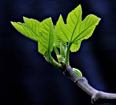 Spring is absolutely my favorite tree time of the year.
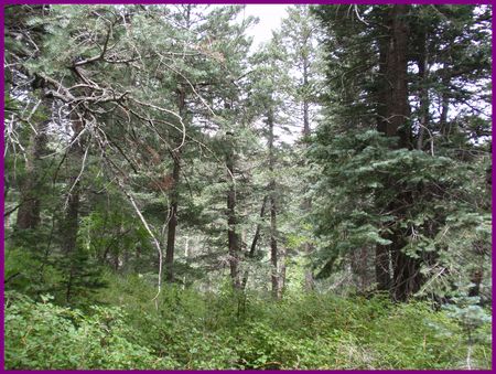
  It doesn’t last long, this lacy phase. And it’s ephemeral. Trees in summer—resplendent in green—and trees in fall—outrageously dressed—are easy to capture in photographs; trees in spring are not. So I celebrate this brief, ephemeral moment of trees in spring that signals winter is really over, life is being renewed, and brighter days are ahead.